
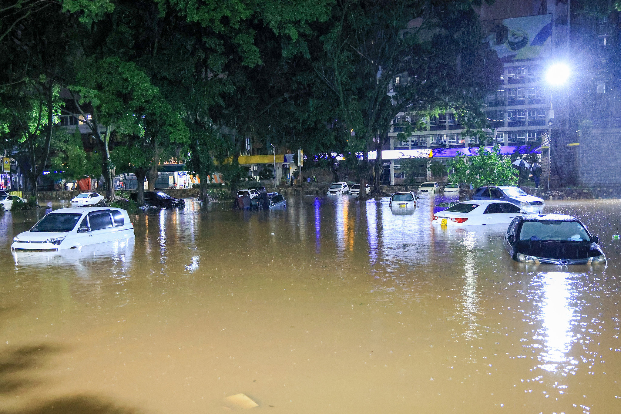
Kenya is preparing for a potentially unusually wet October–December season as a strengthening El Niño raises the likelihood of above-normal rainfall across many parts of the country.
The Kenya Meteorological Department has warned that there is an 81 per cent probability of a very strong El Niño during October–December 2026, while the US National Oceanic and Atmospheric Administration (NOAA) puts the probability of the phenomenon continuing into early 2027 at 97 per cent.
The World Meteorological Organization (WMO) has separately warned that the Greater Horn of Africa is expected to be warmer and wetter than normal during the final quarter of 2026, with October–December being a particularly important rainfall period for Kenya and neighbouring countries.
But forecasters caution that a strong El Niño does not automatically mean every part of Kenya will experience flooding. Rainfall outcomes also depend on other climate drivers, including conditions over the Indian Ocean.

For communities living near rivers, however, the warning is significant.
Flood danger can increase rapidly when heavy rainfall falls in upstream catchments, sending large volumes of water downstream into already vulnerable floodplains.
Government identifies 18 high-risk counties
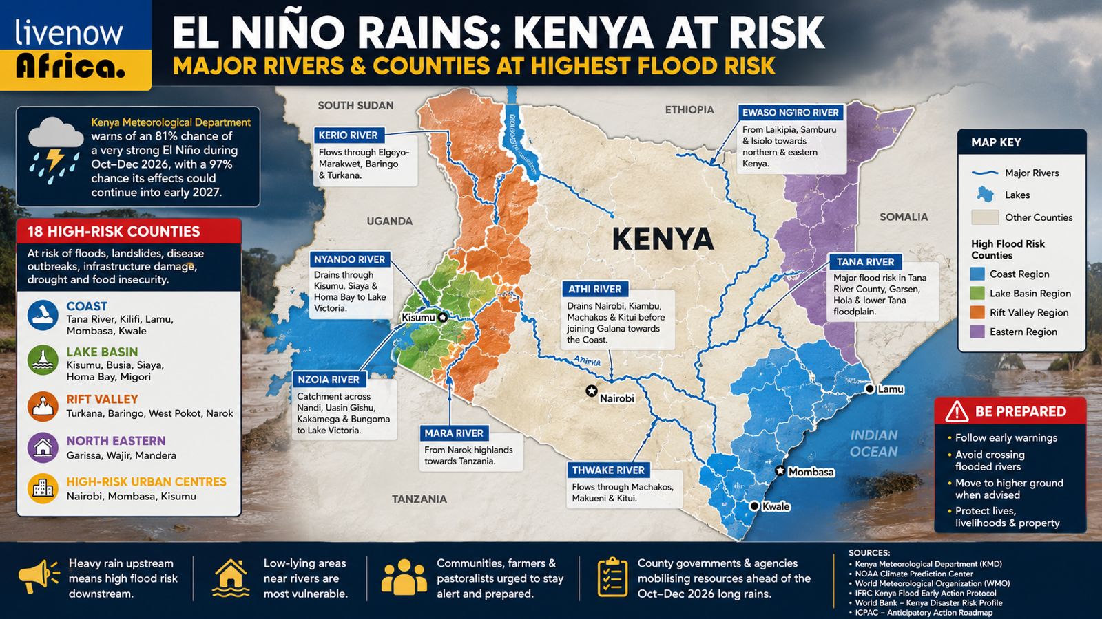
The National Disaster Operations Centre, under the Ministry of Interior and National Administration, has identified 18 counties requiring priority preparedness and response measures ahead of the expected rains.
The assessment covers risks including flash floods, landslides, disease outbreaks, displacement, infrastructure damage, drought and food insecurity. Nairobi, Mombasa and Kisumu have also been highlighted as high-risk urban centres because of flooding, drainage constraints and pressure on essential infrastructure.
At the Coast, Tana River, Kilifi, Lamu, Mombasa and Kwale face heightened exposure to flooding, storm surges, coastal erosion and infrastructure damage.
In the Lake Basin, Kisumu, Busia, Siaya, Homa Bay and Migori have been identified because of potential flooding, landslides, disease outbreaks and displacement.
The Rift Valley counties of Turkana, Baringo, West Pokot and Narok face a more complex combination of risks, including flash floods, landslides, drought and livestock losses.
In the North Eastern region, Garissa, Wajir and Mandera remain vulnerable to water shortages, deteriorating pasture and food insecurity, showing that El Niño's effects will not be uniform across the country.
Tana River: downstream communities remain exposed
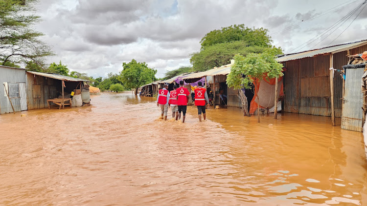
The Tana River basin is one of Kenya's most important flood-risk zones.
The river runs from Kenya's highlands through the lower Tana before reaching the Indian Ocean. Communities in areas around Garsen, Hola and the lower Tana floodplain can be particularly vulnerable when river levels rise.
The International Federation of Red Cross and Red Crescent Societies (IFRC) has previously identified the lower Tana as a recurrent flood-risk area. Its early-action planning notes that significant floods have affected communities in the basin in several previous years.
The experience of the 2023 El Niño season illustrates the potential scale of the threat. The IFRC and Kenya Red Cross launched a major emergency appeal after El Niño-enhanced floods affected communities across the country, with Tana River among the areas requiring humanitarian assistance.
For residents along the lower Tana, the danger is therefore not only rainfall within the county. Heavy precipitation in upstream parts of the basin can translate into rising river levels downstream.
Athi River: Nairobi's rain can become a downstream problem
The Athi River basin presents another major flood pathway.
Nairobi and surrounding areas form part of the wider Athi drainage system. Intense rainfall in Nairobi, Kiambu and the upper catchment can increase flows through rivers and tributaries before water moves downstream towards Machakos and Kitui and eventually into the lower Athi-Galana system.
This makes urban flooding more than a city problem.
When drainage systems are overwhelmed, runoff can enter rivers rapidly. Communities living close to river channels, bridges and floodplains downstream may then face rising water levels.
Kenya's national anticipatory-action framework identifies the Athi basin, alongside the Tana, Lake Victoria, Ewaso Nyiro and Rift Valley basins, as a significant area for seasonal riverine flood risk.
Lake Victoria Basin remains a major concern
Western Kenya also faces significant flood exposure, particularly around the Nyando and Nzoia river systems.
The Nyando River drains towards the Lake Victoria lowlands, where communities in the floodplains have experienced repeated flooding.
The World Bank's disaster-risk assessment identifies the Kano Plains around the Nyando basin and areas along the Nzoia and lower Tana as among Kenya's important river-flood hotspots.
The Nzoia River is another river to watch. Its basin extends across parts of western Kenya before reaching Lake Victoria. Communities and farmland close to the river remain exposed when sustained rainfall causes river levels to rise.
The World Bank's Kenya Water Security and Climate Resilience Project has specifically targeted flood protection for communities living along the Nzoia River, underscoring the long-standing exposure of settlements in the basin.
Ewaso Ng'iro and northern river systems
The Ewaso Ng'iro basin also deserves close monitoring.
The river system serves communities across parts of Laikipia, Samburu, Isiolo and northern Kenya. Although the region is frequently associated with drought, intense rainfall in the upper catchment can produce sudden river rises and flash floods.
This highlights an important feature of the 2026 outlook: El Niño does not mean that every location will simply become wetter.
Some areas may experience flooding while others continue to struggle with water scarcity, pasture shortages or food insecurity. Government preparedness plans therefore include both flood and drought risks.
Kerio, Turkwel and Mara rivers
Other river systems will also require close observation.
The Kerio River, flowing through parts of the Rift Valley towards Lake Turkana, can become dangerous when intense rainfall occurs in its upper catchment. Communities in low-lying areas may face flash floods and rapidly changing river conditions.
The Turkwel River is another important system in northwestern Kenya, where sudden increases in water flows can threaten settlements, roads, farms and livestock.
In Narok, the Mara River is particularly important to communities, agriculture and livestock. Heavy rainfall in its upper catchment can increase river flows downstream and create risks for communities on both sides of the river system.
Flooding is not only a rural problem
Kenya's cities face a separate but connected challenge.
Nairobi, Mombasa and Kisumu have been classified by the government as high-risk urban centres. Heavy rainfall can overwhelm drainage networks, flood roads and disrupt transport, electricity, water services and other critical infrastructure.
In Nairobi, runoff from densely developed areas can reach waterways quickly, particularly where drainage is blocked or river corridors have been heavily settled.
The result can be a combination of flash flooding in urban areas and rising river flows downstream.
Lessons from the 2023–24 floods
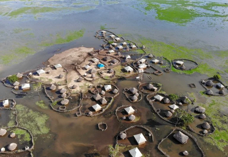
Kenya's recent experience shows why early preparation matters.
During the 2023–24 El Niño-enhanced floods, the Kenya Red Cross and IFRC mounted a major humanitarian response. An IFRC emergency appeal initially estimated hundreds of thousands of people affected, with the figure later rising to more than 890,000 across the affected seasons.
Kenya's anticipatory-action roadmap also notes that riverine floods affect tens of thousands of people in a typical year, with major exposure concentrated around river basins and flood-prone urban areas.
The lesson for 2026 is straightforward: communities should not wait for rivers to burst their banks before acting.
Early warning will be critical
The latest forecasts provide an opportunity for authorities, communities and humanitarian agencies to prepare before the heaviest rains arrive.
That includes clearing drainage channels, checking bridges and roads, identifying evacuation routes, protecting water sources, pre-positioning emergency supplies and ensuring communities receive timely weather and river-level warnings.
For people living near rivers, authorities recommend taking warnings seriously, avoiding crossing flooded rivers and moving to safer ground when evacuation orders are issued.
The WMO says October–December contributes a substantial share of annual rainfall in parts of the Greater Horn of Africa, making the coming season particularly important for agriculture, water resources and disaster preparedness.
The bigger picture
The developing El Niño is both a risk and a planning challenge for Kenya.
Above-normal rainfall could replenish reservoirs, improve pasture and support agriculture in some areas. But intense or poorly distributed rainfall can also trigger floods, landslides, crop losses, disease outbreaks and damage to roads, homes and other infrastructure.
The key question is therefore not simply how much rain Kenya will receive, but where it will fall, how intensely it will fall and what happens to that water once it reaches Kenya's river systems.
With forecasts pointing to a potentially very strong El Niño and government agencies already identifying high-risk counties, the weeks before October will be crucial for preparedness.
For communities along the Tana, Athi, Nyando, Nzoia, Ewaso Ng'iro, Kerio, Turkwel and Mara systems, early warning could make the difference between a manageable rise in water levels and a humanitarian emergency.
Related Stories
- Ruto’s Communication Crisis: Why a Government That Says It Wants ‘One Voice’ Keeps Losing the Information Battle
- El Niño: How to protect your family before, during and after floods
- Beyond Aid: How Japan’s Development Philosophy Is Shaping Kenya’s SME Future
Category: Features
 Facebook
 Twitter / X
 WhatsApp
 LinkedIn
 Telegram
 Reddit