
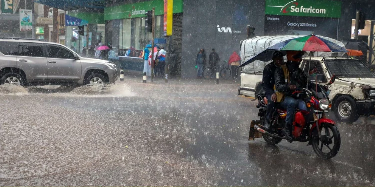
Kenya is heading into a period of sharply contrasting weather, with most of the country expected to remain dry while eight counties could receive rainfall between August 13 and 20.
The short-term forecast comes as attention turns to a much bigger weather question: what could happen when Kenya enters its October-December short-rains season?
The Kenya Meteorological Service expects rainfall in Bungoma, Trans Nzoia, Nakuru, Uasin Gishu, Elgeyo Marakwet, Kericho, Nyandarua and Nyeri during the week.
For much of the rest of the country, however, the outlook is predominantly dry. Some areas are expected to experience intermittent cool and cloudy conditions, particularly across parts of the Central Highlands, Nairobi, the Rift Valley and the north-east.

That contrast is important. A forecast of rain in a handful of counties does not mean Kenya has entered the anticipated El Niño rains.
The larger concern is still several weeks away.
Why El Niño is now drawing attention
Global climate forecasts show that El Niño is developing in the tropical Pacific and is expected to strengthen.
The World Meteorological Organisation said in June that there was an 80 per cent probability of El Niño conditions during June-August, with the likelihood rising to about 90 per cent for the September-December period. Most models suggested the event would be at least moderate, with some pointing to a strong event.
A later WMO seasonal update indicated a rapid move towards a strong El Niño during July-September, with the possibility of the event strengthening further during the northern autumn. The same outlook pointed to the development of a positive Indian Ocean Dipole, another climate pattern that can influence rainfall over East Africa.
This is why Kenya's October-December season is being watched closely.
El Niño does not mean that every part of Kenya will automatically receive torrential rain. Its effects depend on other weather systems, including the Indian Ocean Dipole, as well as local conditions.
Eight counties in the near-term rainfall zone
For the current week, the Kenya Meteorological Service expects most of the country to remain generally dry.
Rainfall is, however, forecast in parts of:
- Bungoma
- Trans Nzoia
- Nakuru
- Uasin Gishu
- Elgeyo Marakwet
- Kericho
- Nyandarua
- Nyeri
Nyandarua and Nyeri also feature among counties where cool and cloudy conditions are expected.
Other counties that could experience intermittent cool and cloudy weather include Embu, Kiambu, Kirinyaga, Laikipia, Meru, Murang'a, Nairobi, Tharaka-Nithi, Machakos, Kajiado, Taita Taveta, Marsabit and Wajir.
The Kenya Meteorological Service says its short-range forecasts are designed to support decisions in sectors such as agriculture, transport, health and disaster management.
The bigger concern is not this week's rain
The immediate forecast should not be confused with the seasonal El Niño outlook.
Kenya's July-September climate outlook already anticipated generally dry conditions in many areas, while some parts of the Highlands and Lake Victoria Basin were expected to receive below-average rainfall.
That makes the anticipated shift later in the year particularly significant.
The WMO says El Niño can alter global rainfall and temperature patterns because unusually warm Pacific waters affect atmospheric circulation far beyond the ocean itself.
For Kenya, the practical question will be where the rain falls, when it arrives and how intense individual events become.
A season with above-average rainfall can benefit farmers and replenish water supplies. But intense rainfall in a short period can produce a very different outcome, including flash floods, landslides, waterlogging and damage to roads and homes.
Counties told not to wait for the rain
The warning is already moving beyond weather forecasts and into disaster preparedness.
Counties considered vulnerable have been urged to activate anticipatory measures ahead of the October-November-December season.
Among the areas being watched are parts of Homa Bay, Kisumu and Nakuru, where rising water levels in several lakes could increase exposure to flooding if heavy rainfall materialises.
Kenya Meteorological Department disaster-risk management expert Misiani Zachary has warned that the combination of a strong El Niño and a positive Indian Ocean Dipole could produce an earlier and potentially intense start to the rainy season.
He said the combination could increase the likelihood of torrential rain and flash flooding in parts of the country.
Lake Victoria and Lake Naivasha are among the water bodies being watched because heavy rainfall can raise water levels and increase the risk of flooding in vulnerable areas.
What Kenyans should watch next
The most important forecasts will come closer to the October-December season.
Meteorologists will continue monitoring the Pacific Ocean, the Indian Ocean and atmospheric conditions before refining the seasonal outlook.
For farmers, county governments and communities in flood-prone areas, that means preparation should begin before the first major rains arrive.
For now, Kenya remains largely dry.
But the weather picture could look very different in a matter of weeks.
The current message from meteorologists is therefore less about predicting one dramatic rainfall event and more about using the warning window to prepare before the risks become immediate.
Related Stories
- Who Was Gloria Sekeiyan Khalwale? A Mother of Eight Remembered After Sudden Death
- JSC moves to tighten accountability for judges without crossing removal threshold
- Ruto hosts Kenya’s top young performers as Music Festival reaches State Concert
Category: News
About the Author
Maureen Onyango is a journalist passionate about storytelling, life coaching and spiritual lessons. She studied at the Kenya Institute of Management and enjoys telling stories that inform, inspire and empower communities.
 Facebook
 Twitter / X
 WhatsApp
 LinkedIn
 Telegram
 Reddit